
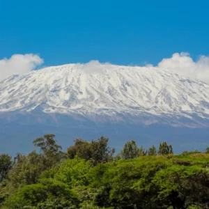
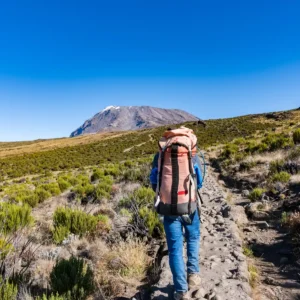
The Rongai Route begins at Rongai Gate (1,950 m), approximately 96 km from Moshi via a longer
drive north toward the Kenyan border. Day one is a 3–4 hour walk through open pine plantations
and farmland before entering the national park proper, reaching First Cave Camp (2,600 m). The
vegetation is markedly drier and more open than the southern routes — more reminiscent of the
Kenyan moorland than the lush Kilimanjaro rainforest.
Days two and three ascend through Kikelelwa Camp (3,600 m) and Mawenzi Tarn Camp (4,330 m),
approaching from the northeastern flank with excellent views of Mawenzi Peak (5,149 m) across
the Saddle. The scenery here — a rugged, volcanic landscape with alpine desert and scattered
giant groundsels — is among the least-visited terrain on the mountain.
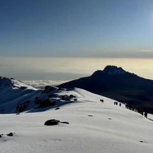
Day four crosses The Saddle to Kibo Hut (4,703 m) or School Hut (4,750 m), the alternative
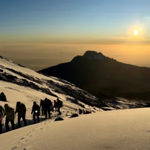
high camp used by Rongai trekkers. The route joins the main Kibo circuit here. Summit night
begins between midnight and 1 AM, ascending the northeastern face of Kibo to Gilman's Point
(5,685 m) on the crater rim. The final 1.5–2 hour walk along the crater rim reaches Uhuru Peak
(5,895 m).
Descent follows the Marangu Route back to the southeastern Marangu Gate, creating a satisfying
cross-mountain traverse. Most trekkers complete the Rongai Route in 6 days, though a 7-day
option with an extra acclimatisation night at Mawenzi Tarn Camp is available and recommended
for those who prefer a slower ascent profile.
ROUTE HIGHLIGHTS
-
The only northern approach on Kilimanjaro — completely different vegetation, landscape character, and crowd levels from the southern routes
-
Open semi-arid moorland on the lower slopes gives wide-angle views over the Kenyan plains and Amboseli basin
-
Drier conditions year-round — the northern aspect receives significantly less rainfall than the south and east
-
Fewer trekkers throughout — one of the quietest routes on the mountain outside the Northern Circuit
-
Caves along the trail at Second Cave Camp (3,450 m) — a distinctive feature unique to this northern approach
-
Summit approach to Gilman's Point via the northeastern crater rim — a different final ascent angle from the southern routes
-
Most viable wet-season alternative — the northern slopes stay drier during April–May when southern routes are at their worst